


India and Mauritius Deepen Strategic Cooperation Near Chagos Islands
- Triplet 59
- Oct 15, 2025
- 6 min read

Port Louis / New Delhi — Analysis
India and Mauritius have quietly advanced their strategic partnership with the signing of an agreement establishing a satellite tracking station near the Chagos Archipelago. The pact, concluded during high-level bilateral discussions in Port Louis, reflects a deepening of cooperation in maritime security, space technology, and oceanographic research within the Indian Ocean Region (IOR).
Officials from both governments confirmed that the new facility will enhance regional capabilities in satellite communication, tracking, and data sharing, while reinforcing Mauritius’s sovereignty and India’s technological outreach.

A Partnership Anchored in Shared Ocean Priorities
The agreement comes amid a series of collaborations between the two nations over the past decade. India and Mauritius have long shared strategic interests in safeguarding sea lanes, enhancing maritime awareness, and promoting sustainable use of ocean resources.
Under the latest accord, India will support Mauritius in establishing a ground-based facility capable of tracking satellites, monitoring telemetry data, and contributing to space research programs managed by the Indian Space Research Organisation (ISRO).
Mauritius’s Ministry of Blue Economy, Marine Resources, Fisheries and Shipping described the move as a “natural extension of long-standing cooperation” between the two countries.
“Mauritius and India have an enduring friendship built on mutual trust and shared aspirations for peace and development in the Indian Ocean,” a ministry spokesperson said. “This new facility strengthens our scientific capacity and reaffirms our position as a responsible maritime state.”
Expanding the Framework of India–Mauritius Cooperation
The satellite tracking initiative is part of a broader cooperation agenda that spans defence, hydrography, renewable energy, and digital connectivity.
India has consistently assisted Mauritius in modernising its maritime surveillance systems, including the supply of Dornier aircraft, patrol vessels, and radar equipment. The two countries conduct joint hydrographic surveys, share oceanographic data, and collaborate on navigational charting of the Mauritian Exclusive Economic Zone (EEZ).
With Mauritius gaining administrative authority over the Chagos Islands following its sovereignty agreement with the United Kingdom, the country’s EEZ expanded significantly. This created an immediate need for advanced monitoring and mapping technologies — areas in which India’s expertise plays a key role.
Indian officials view the collaboration as mutually beneficial. “The initiative enhances regional maritime domain awareness while building local capabilities,” an Indian diplomat familiar with the talks said. “It represents a model of South–South cooperation driven by transparency and capacity-building.”
Technical Scope and Strategic Location
The planned facility will form part of India’s global network of ground stations that support space missions, satellite launches, and communication systems.
Engineers from ISRO and the Mauritius Research and Innovation Council are expected to collaborate on installation and training. The station’s functions will include:
Telemetry, tracking, and command (TT&C) operations for Indian satellites.
Data reception for Earth observation and meteorological systems.
Space situational awareness and orbit analysis.
Maritime data integration for weather and navigation safety.
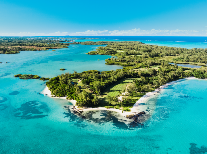
Located near the Chagos Archipelago, the facility offers a vantage point in the middle of the Indian Ocean — a zone critical for global trade, undersea cable routes, and weather observation.
Officials emphasised that the site is strictly civilian and scientific in nature, dedicated to research, communication, and environmental monitoring rather than military surveillance.
Mauritius’s Blue Economy Vision
For Mauritius, the satellite project aligns with its Blue Economy Strategy, which seeks to combine environmental stewardship with technological innovation. The government has identified space-based data, hydrographic mapping, and maritime security as essential tools for managing its vast ocean territory.
The satellite tracking station will enhance Mauritius’s ability to monitor fisheries, track illegal maritime activity, and support disaster-management operations. It also opens pathways for local scientists and engineers to engage in advanced research with Indian institutions.
Dr. Kaviraj Sharma Sukon, Director-General of the Mauritius Oceanography Institute, noted that the new collaboration will expand access to real-time data on weather systems, ocean currents, and ecological changes.
“Satellite technology underpins effective ocean governance,” he said. “Our cooperation with India brings precision and continuity to data collection, which directly supports climate resilience and sustainable development goals.”

India’s Expanding Maritime and Space Outreach
India’s growing engagement with Indian Ocean island nations is part of its broader Security and Growth for All in the Region (SAGAR) policy, announced in 2015. Through SAGAR, India positions itself as a partner in capacity-building and disaster-response readiness rather than as a dominant power.
The collaboration with Mauritius complements India’s ongoing projects in Seychelles, Maldives, and Madagascar, where it assists in radar networks, coastal infrastructure, and training for maritime personnel.
In the space domain, India has successfully launched satellites for several African and Indian Ocean countries, emphasising affordable access to space and shared benefits of technology.
An ISRO official explained that Mauritius offers a stable, trusted location for expanding ground infrastructure. “The Indian Ocean is central to our mission planning, and Mauritius provides excellent geographical and diplomatic conditions for cooperation,” the official said.
Chagos Islands and Diego Garcia: Balancing Geography and Diplomacy
The Chagos Archipelago — comprising more than 60 islands — lies approximately halfway between Africa and Indonesia. The area has historically been of geopolitical interest due to its proximity to major shipping routes and its location near the U.S.–UK military base on Diego Garcia.
Under the recent UK–Mauritius sovereignty agreement, Mauritius regained control over the archipelago while the Diego Garcia base remains under a long-term lease arrangement between London and Port Louis.
Officials in both India and Mauritius have stressed that the new satellite tracking project respects all existing international agreements and legal frameworks.
Mauritian Foreign Minister Maneesh Gobin clarified that “the cooperation with India is peaceful, transparent, and consistent with our sovereign responsibilities.”
Environmental Monitoring and Regional Data Sharing
In addition to space and communication functions, the station will play a major role in environmental observation. The facility will collect and share satellite data related to:
Marine pollution detection.
Coral reef health and coastal erosion.
Cyclone tracking and early-warning systems.
Ocean temperature and salinity mapping.
The initiative is designed to contribute to regional and global databases managed by the Indian Ocean Commission and the Intergovernmental Oceanographic Commission (IOC-UNESCO).
Through these platforms, Mauritius and India aim to enhance resilience against climate change impacts in small island developing states (SIDS).

Economic and Educational Benefits for Mauritius
The tracking station will generate employment opportunities for Mauritian engineers, data analysts, and technicians. Training programmes are planned through ISRO’s Space Applications Centre, while local universities are expected to integrate space-science modules into their curricula.
Mauritius’s Minister of Information Technology, Deepak Balgobin, emphasised the importance of knowledge transfer:
“This partnership is not only about equipment or infrastructure; it is about skills, innovation, and opportunity. Our youth will gain exposure to cutting-edge technologies that define the next generation of digital economies.”
Regional and International Reactions
The development has drawn measured interest from other Indian Ocean nations and regional organisations.
Officials from Seychelles and Madagascar have expressed support, viewing the Mauritius facility as part of a cooperative approach to regional security and disaster preparedness.
Diplomatic observers note that the project demonstrates how small island states can leverage partnerships with emerging powers to strengthen sovereignty and technological capacity.
Analysts from the Indian Ocean Rim Association (IORA) describe the deal as a “win-win model” that avoids zero-sum competition.
“Unlike militarized projects elsewhere, this arrangement centers on transparency, environmental monitoring, and shared scientific goals,” said Professor Asha Menon, a regional policy expert at the University of Delhi.
Legal Framework and Transparency Measures
Both governments have underscored that all data collected will remain subject to strict confidentiality and international law. The agreement reportedly includes:
Provisions for joint oversight of operations.
Data-sharing protocols with mutual consent.
Compliance with International Telecommunication Union (ITU) standards.
Environmental impact assessments before full commissioning.
Mauritius’s Attorney-General’s Office confirmed that the facility’s operations comply with national laws on sovereignty, telecommunications, and environmental protection.
Future Outlook: Cooperation Beyond Chagos
The satellite tracking initiative may serve as a template for future collaborations in the region. Discussions are reportedly underway for a second phase that could involve joint small-satellite launches focused on maritime data collection.
India has offered to assist Mauritius in establishing a National Space Research Framework, including scholarships and fellowships for Mauritian students to train in India.
The two countries are also exploring public-private partnerships in data analytics, renewable energy mapping, and sustainable tourism — all of which rely heavily on space-based monitoring systems.
A Partnership Rooted in Trust and Mutual Growth
The establishment of a satellite tracking station near Chagos underscores a significant step forward in India–Mauritius relations. It merges technical expertise with shared strategic priorities, reinforcing both nations’ commitment to peaceful cooperation in the Indian Ocean.
For Mauritius, it represents the assertion of sovereignty through science and technology. For India, it demonstrates responsible regional leadership grounded in partnership and transparency.
As construction progresses, the facility stands as a symbol of how small states and emerging powers can collaborate to harness space for sustainable growth and maritime security — an example of diplomacy through development in the twenty-first century.
#IndiaMauritius #ChagosIslands #IndianOcean #SatelliteTracking #MaritimeSecurity #SpaceCooperation #DiegoGarcia #Diplomacy
We are delighted to work together in promoting the beauty and opportunities of Mauritius.
Our websites, Mauritius Life, Veri Global, and Property Finder, are committed to providing valuable information, resources, and services related to Mauritius, its culture, economy, real estate, and more.
Please explore our websites to discover the rich cultural heritage, breathtaking beaches, thriving economy, top-notch real estate listings, investment administration, and knowledge that Mauritius has to offer. Together, we aim to showcase the best of Mauritius and assist you in making informed decisions about living, investing, and experiencing all that this beautiful island has to offer.


Comments